

Marcaj
Offline hiking and cycling maps of Romania
Every marked trail in Romania, the relief and the forest, with routes you can plan and follow with no phone signal. Built to last a whole day in the mountains on one charge.
- Free
- No ads
- No account
- Works offline
- Android
Screenshots
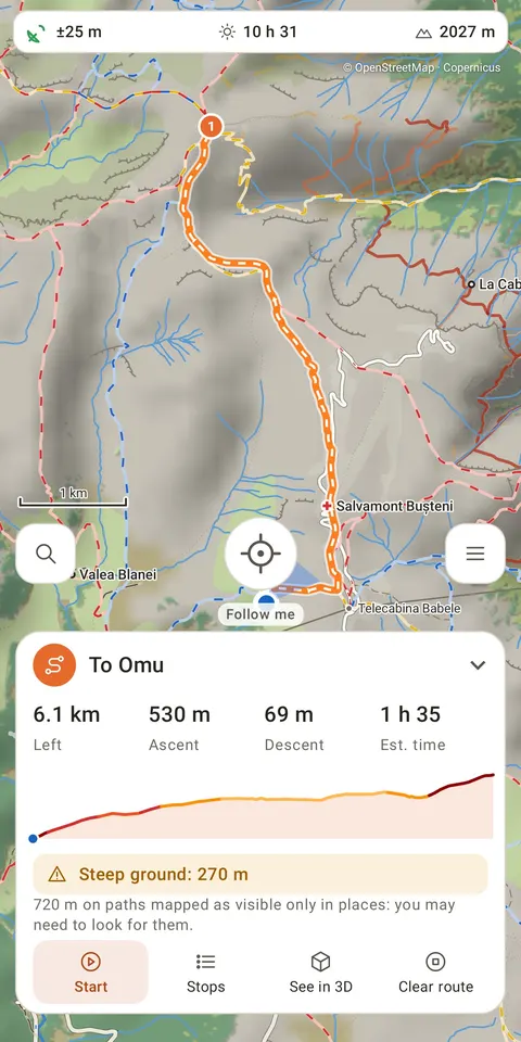
A route with its distance, climb and a realistic time 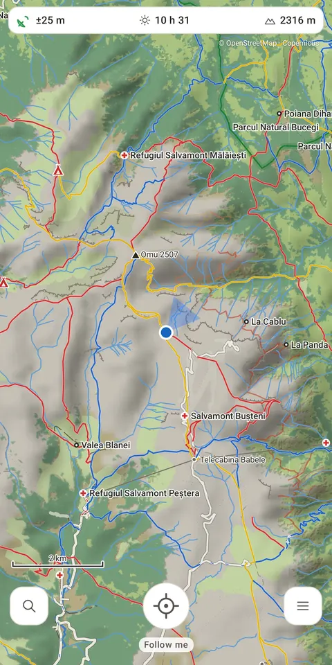
Every marked trail, the relief and the forest 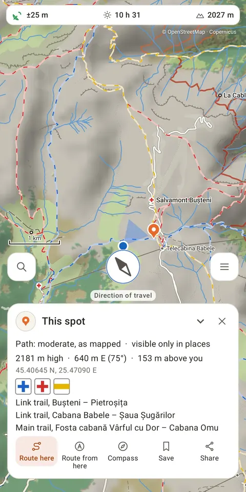
Tap the map: which trails pass there and where they lead 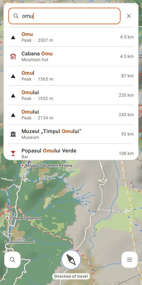
Search summits, huts, springs and villages 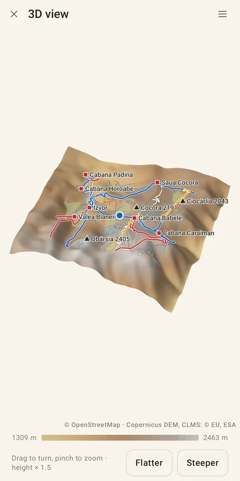
Any area in 3D, with its trails and huts 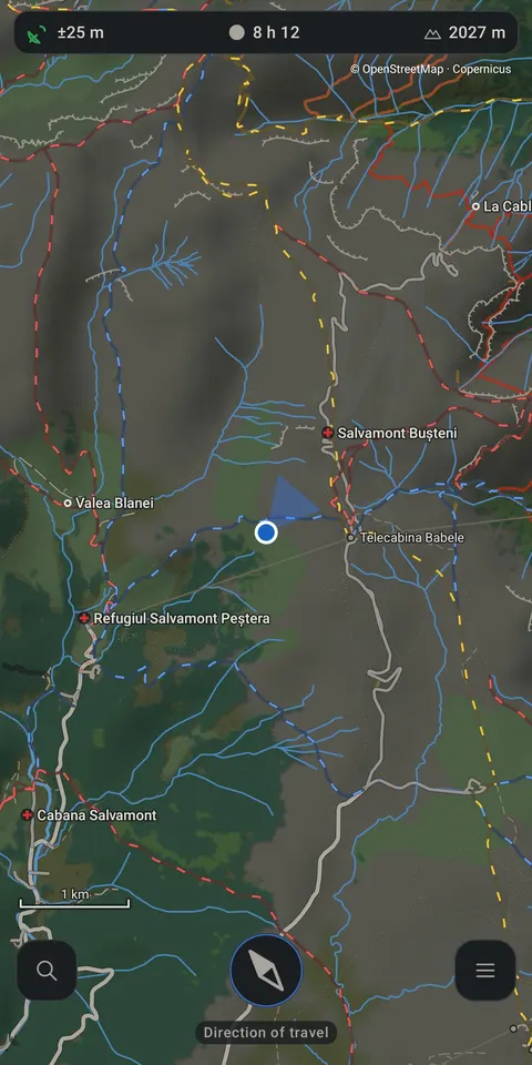
A dimmed map for the night 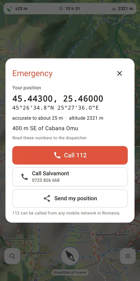
Your position, ready to read to 112 or Salvamont
What it does
All of Romania, offline
- The whole country is inside the app: nothing to download, no internet connection and no account needed.
- Every waymarked trail, with what its mark means and where it leads, for example “Main trail, Băișoara – Muntele Mare”.
- Peaks with their heights, mountain huts and refuges, Salvamont bases, springs and drinking water, passes, fords, villages, and national and natural parks.
- Marked cycling and mountain-bike routes, and every place of interest outside towns.
- Relief from the Copernicus elevation model and real forest cover from Copernicus satellite maps.
Routes with realistic times
- Plan a route along trails, with stops, and see its distance, climb and a realistic walking time.
- Hold the route to add a stop, drag a stop to move it, draw a straight leg where the map has no path, and see on the elevation profile how steep each stretch is.
- Steep and very steep stretches are marked on the map, and the sunset time tells you whether you will be down before dark.
By bike, car or 4×4
- Bike mode plans the shortest way, counting climbs extra, along forest roads and tracks as readily as asphalt, and avoids main roads where it can.
- Driving mode keeps to paved roads and respects roads closed to motor vehicles, one-way streets and barriers.
- The 4×4 mode, experimental, seeks out dirt roads and tracks, but never ones closed to vehicles or private. Check access on the ground.
- Dirt roads are shown exactly as OpenStreetMap maps them: the map never guesses how passable a road is.
Navigation that keeps you on the trail
- Start a route and the map follows you, turned the way you are going.
- If you leave the route, Marcaj tells you, shows the way back and offers a new route.
- It works with the phone in your pocket.
A safe way back
- Start a trip and Marcaj records the way you actually went.
- “Back the way I came” turns it into a route back to the start, along a way you know is passable.
- Trips stay on your phone; share them as GPX files whenever you like.
Built for a whole day outdoors
- Between GPS readings your position is carried forward by your steps, so GPS is used far less and the battery lasts longer.
- An emergency screen with your coordinates and altitude, ready to read to 112 or Salvamont.
- A warning when the air pressure drops fast and the weather may turn.
Questions
Does Marcaj work without a phone signal?
Yes. The maps of the whole country are inside the app, and GPS needs no signal. Marcaj has no internet access at all.
Is it free?
Yes, with no ads, no paid features and no account.
Which trails does it show?
Every waymarked hiking trail in Romania that is in OpenStreetMap, with its mark, its kind (main, link, local) and where it leads, plus marked cycling and mountain-bike routes.
Can I use it to get back if I get lost?
Start a trip before you set out: Marcaj records your way, and “Back the way I came” makes it a route back to the start. If you are in danger, the emergency screen shows your position for 112 or Salvamont.
Is it on iPhone?
Not yet: Marcaj is for Android phones, from Android 8.
Where does the map data come from?
Trails, roads and places from OpenStreetMap; relief from the Copernicus elevation model; forests from the Copernicus Land Monitoring Service.
Marcaj has no internet access: your position, trips and places stay on your phone. Privacy policy · Terms of use
Map data © OpenStreetMap contributors (ODbL). Terrain: Copernicus DEM, © DLR e.V. and © Airbus, provided under COPERNICUS by the EU and ESA. Forests: © European Union, Copernicus Land Monitoring Service 2023, EEA.